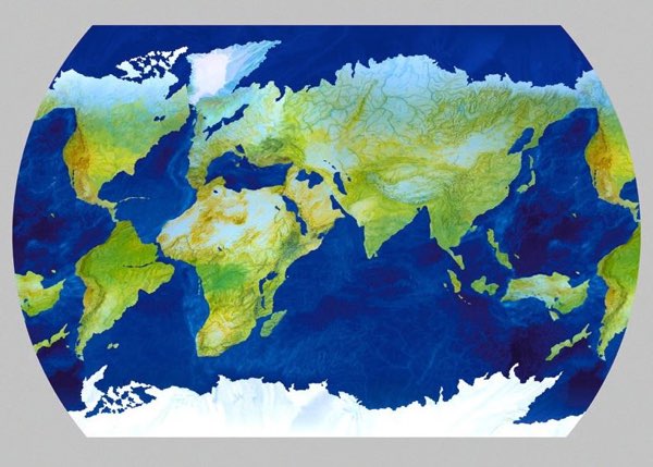
Here is a map, slightly off-kilter but completely recognizable, by Gaicomo Faiella. Can you tell what is special/interesting about it? (Hat tip to Joe Polchinski, and following his lead I won’t reveal the answer in this post — but feel free to leave guesses/spoilers in the comments.)
29 thoughts on “Purposeful Distortion”
Comments are closed.

Where can I find a map that has ocean bottom depths reversed to display as above-sea- level heights? And the land could be shown as totally at sea level. It would be a fish’s view of the world.
Um… Sarah Palin can’t just see Russia, she’s in it?
The map does look to be invertible. Also if this is how the continents were at any time the Atlantic ocean would possibly have been fresh water.
If you stick a pin RIGHT THERE… in the middle of the shoreline of the east coast of what strangely looks to be India, and rotate the land shape 180 degrees and color the land as if ocean, you get a flipped global view of greater than 360 degrees …